Scientists Terrifying New Discovery Under Sahara Desert Changes Everything!
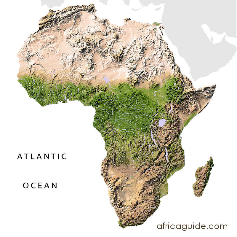
This is the map of Africa. If you look to the South, you will see lush vegetation with lots of greenery. However, when you go north, things are different. Covering multiple countries, it is the most gigantic desert globally with miles and miles of dune formation. Altogether, the Sahara Desert covers 9 million square kilometers, meaning it could swallow Spain 18 times.
However, did you know that this vast stretch of sterile sand, covering a third of the African continent, was covered in lush vegetation thousands of years ago? What happened to the Sahara, and what is happening to it right now? In this article, we will look at the terrifying discoveries scientists have made under the Sahara Desert.
The Atlantic Ocean borders the Sahara on the west, the Red Sea on the east, the Mediterranean Sea on the north, and the Sahel Savannah on the south. The enormous desert spans 11 countries: Algeria, Chad, Egypt, Libya, Mali, Mauritania, Morocco, Niger, Western Sahara, Sudan, and Tunisia.
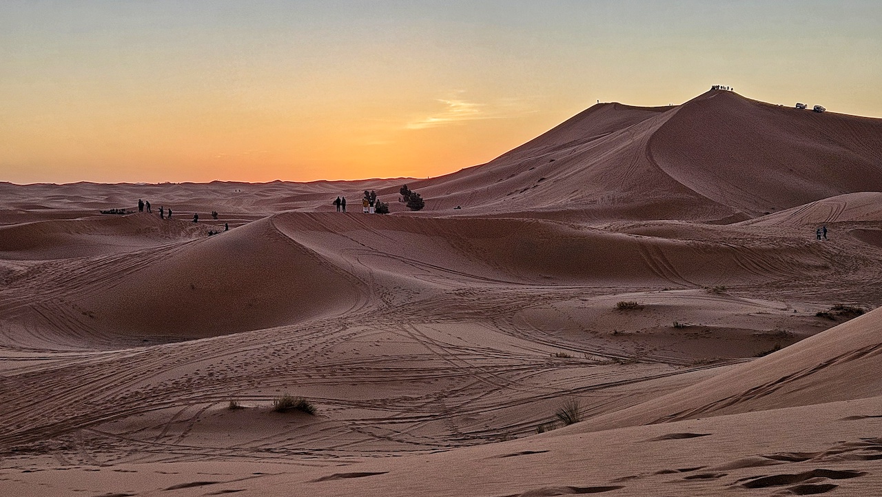
The Sahara Desert is most famous for sand dune fields, often featured in movies. The dunes can reach almost 600 feet (183 meters) high, though they only cover about 15 percent of the entire desert. Other topographical features include mountains, plateaus, sand and gravel-covered plains, salt flats, basins, and depressions.
The Sahara used to be a tropical area, so how did it become the harsh, arid region it is today? The answer to this question takes us several thousand years back. The Sahara has long been subject to periodic bouts of humidity and aridity. These fluctuations are caused by slight wobbles in the tilt of the Earth’s orbital axis, which, in turn, changes the angle at which solar radiation penetrates the hemisphere.
At repeated intervals throughout Earth’s history, more energy poured in from the Sun during the West African monsoon season. During those times, known as African Humid Periods, much more rain fell over North Africa. With more rain, the region saw more greenery, rivers, and lakes.
But between 8,000 and 4,500 years ago, something strange happened. The transition from humid to dry occurred far more rapidly in some areas than could be explained by orbital precession alone, resulting in the Sahara Desert as we know it today.
In his study, archaeologist David Wright tells us what happened next. As he poured through the archaeological and environmental data, chiefly obtained from sediment cores and pollen records dated to the same period, he noticed a pattern. Where the archaeological record showed the presence of pastoralists—humans with their domesticated animals—there was a corresponding change in the types and variety of plants.
It was as if every time humans, along with their goats and cattle, moved across the grasslands, they turned everything to scrub and desert in their wake. Wright concluded that overgrazing the grasses reduced the amount of atmospheric moisture, as plants give off moisture that produces clouds. This may have triggered the end of the humid period more abruptly than the orbital changes alone could explain. These nomadic humans may have also used fire as a land management tool, which would have sped up the desertification process.
Now, when you think of the Sahara Desert, do you imagine whales frolicking on the rolling sand dunes? While that’s unlikely—since whales can’t survive outside of water—there is evidence that the ancestors of modern whales once swam in what is now the hot African desert.
Rewind to 1902, when a team of geologists guided their camels into a valley in Egypt’s Western Desert. Strong winds had sculpted sandstone rocks into strange shapes. At night, the moonlight was so bright it made the sand glow like gold. A nearby hill was known as the Mountain of Hell because of the infernal summer heat, but in this arid valley lay the bones of whales.
Some of the skeletons were 50 feet long, with vertebrae as thick as campfire logs. They dated back 37 million years to an era when a shallow tropical sea covered this area and all of Northern Egypt. Although the geologists didn’t realize it at the time, these prehistoric specimens would offer clues to one of evolution’s most nagging questions: How did whales become whales?
One clue found from these long-dead whales was the presence of feet. Scientists had long suspected that whales were terrestrial mammals that eased into the ocean over millions of years, gradually losing their four legs. Modern whales still have vestigial hind leg bones, but little in the fossil record had illustrated this transition until paleontologists began excavating hundreds of whale fossils at Wadi Al-Hitan.
Older specimens of footed whales have since been identified, but the ones found in Wadi Al-Hitan are unparalleled in their numbers and state of preservation. This valley, about a three-hour drive from Cairo, is now a UNESCO World Heritage site, visited by some 14,000 people each year.
But whales are not the only strange discoveries in deserts. You’ve likely heard about the lost city of Atlantis. You might be shocked to know that this famed city is connected to the next discovery in the Sahara Desert.
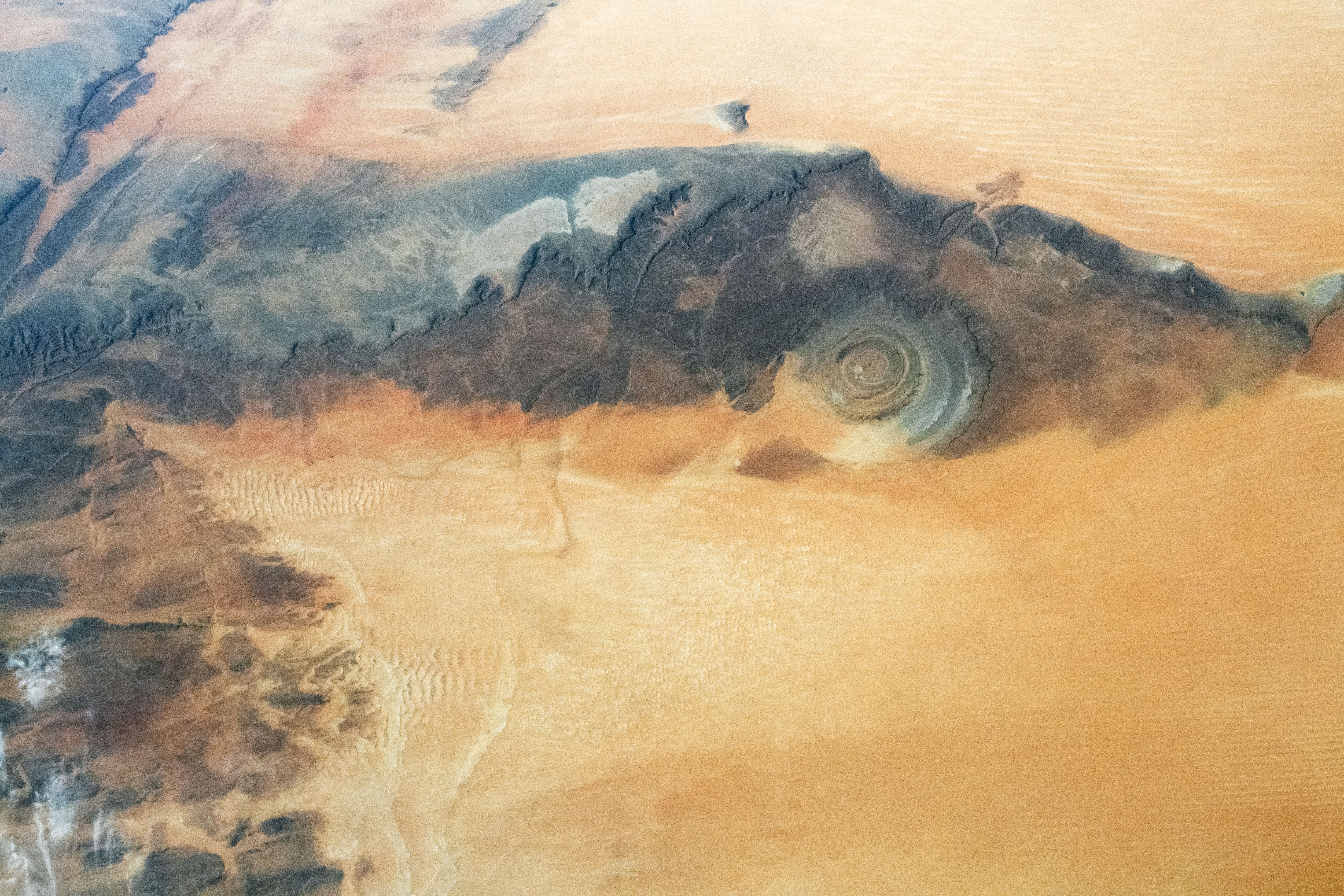
This takes us to the Eye of the Sahara, also known as the Richat Structure or the Guelb er Richât. It is a geological formation in the Sahara Desert that resembles an enormous bullseye, stretching across a 40-kilometer-wide region of the desert in Mauritania. For centuries, only a few local nomadic tribes knew about the formation, but it was first photographed in the 1960s by Gemini astronauts, who used it as a landmark to track their landing sequences.
Geologists initially believed that the Eye of the Sahara was an impact crater created when an object from space slammed into the surface. However, studies of the rocks inside the structure show that its origins are entirely Earth-based. Geologists now conclude that the Eye of the Sahara is a geologic dome, containing rocks that are at least 100 million years old—some of which date back to well before the appearance of life on Earth.
Interestingly, a YouTube video suggests that the Eye of the Sahara might be the remnants of the ringed city Plato described in the 4th Century BC. According to this theory, the structure could be the actual location of Atlantis.
The Sahara continues to reveal its secrets, and the discoveries are far from over.


